Doodle Map
Sketch routes, test areas and meeting points on a live map so every instructor teaches them the same way.
Doodle Map in the app, step by step
Filmed in the live app, at your own pace. Use the player controls to pause, replay or go full screen.
Good to know
- Doodle Map needs location permission. If the map stays blank, allow location access for Driving Instructor Manager in your phone's settings.
- Mark the test centre and the routes you use most often. Everyone in the school then teaches them the same way.
Doodle Map is a live map you can mark up. Use it to record test routes, meeting points and the areas you teach, then keep them for next time.
-
Open Doodle Map
Tap the Doodle Map tile on your dashboard, and allow the location permission when your phone asks so the map can centre on you.
-
Find your area
Search for a place, or scroll and zoom the map to the area you want to record.
-
Change the map layer
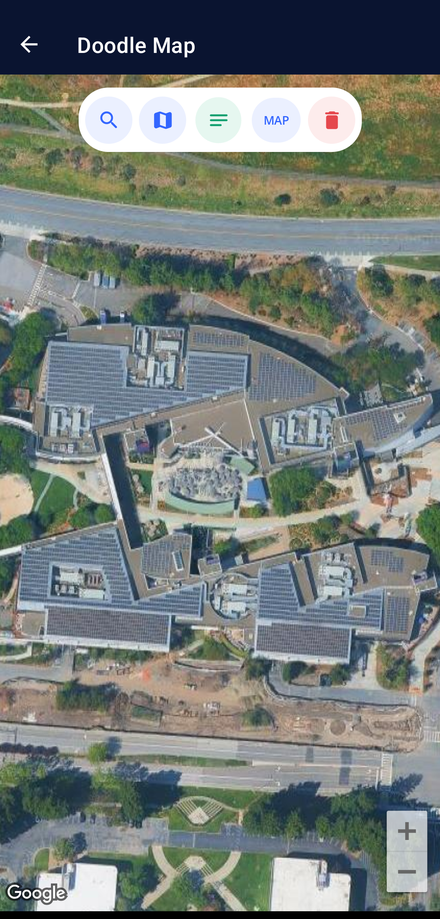
Tap the MAP chip in the toolbar to switch between satellite imagery and the standard street map.
-
Mark up the map
Tap the draw button, then drag your finger across the map to sketch the route, test area or meeting point you want to remember.
-
Use it in lessons
Open Doodle Map during a lesson to show a pupil the exact route, or to brief another instructor on how you teach it.
The controls on this screen
-
Search
Shows or hides the address bar. Type a postcode or street name, then tap Search to jump the map straight to it.
-
Current location
Moves the map back to where you are now — useful when you open Doodle Map somewhere new.
-
Draw
Turns finger drawing on and off. While drawing is on, the map stops panning and zooming so your finger leaves a red line instead.
-
MAP
Switches the layer between satellite imagery and the standard street map. Satellite is the default.
-
Clear
Removes every line and pin you have drawn so you can start a fresh route.